Spatial Planning Unit
The spatial planning unit is responsible for the delivery of the forward planning work programme that maintains the planning policy framework at local level in accordance with the provisions of the planning and development act.
Established in October 2015, the Spatial Planning Unit works in tandem with the Regeneration and Unfinished Housing Estate teams, creating a positive outlook for the development of the county, based on robust planning policy with its roots in a firm evidence base and articulated through the County Development Plan.
Ongoing and future projects within the Spatial Planning Unit Work Programme include:
- Biannual review of the County Development Plan
- Development and implementation of Core Strategy Monitoring provisions
- Review of Local Area Plans (Appendix 1A-F) as required under CDP policy
- Preparation of Landscape Character Assessment (Annex 4) and Local Authority Renewable Energy Strategy (LARES)
- Development and Implementation of Rural Housing monitoring database
- Preparation of Land use and transportation study (s.2.1.6.4 page 70) for Longford Town
Planning Policy

The County Development Plan sits at the top of the County planning Hierarchy. This document sets out “an overall strategy for the proper planning and sustainable development [of its area]” and consists of a written statement and plans indicating the development objectives contained therein to promote appropriate social environmental and economic development within the county over the plan period, which is currently 2015-2021.
Centred around the core strategy, the content of the plan is governed by mandatory and discretionary objectives as set out in section 10 the act, which are further informed by evidence based strategies in areas such as retail, housing and landscape.
As part of the settlement strategy, the plan contains Zoning Provisions (Appendix 1A-F) for specific settlements while addressing areas of flood risk.
There have been two variations of the Plan since its adoption, Variation no. 1 to amend zoning in the Ballymahon area and Variation no. 2 to incorporate the Longford Town and Environs Local Area Plan and some provisions of the Urban Regeneration and Housing Act 2015 to facilitate application of the Vacant Sites Levy in appropriate areas.
Plan content is also informed by guidelines issued by the minister under S.28 of the Act and prevailing government policy such as the provisions of Rebuilding Ireland and other provisions related to the promotion of sustainable development such as those contained in the Climate Action and Low Carbon Development Act. It should be noted that further variations may be needed to incorporate emerging policy within the County Development plan to ensure its application into the future.
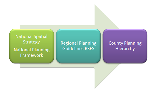
The plan sits within the national planning hierarchy [DIAGRAM] currently consisting of the National Spatial Strategy, under which sit the Midland Regional Planning Guidelines to which the County Development Plan is subordinate.
These higher level strategic documents are to be replaced by the National Planning Framework, work on which is underway and to be followed by the Regional Spatial and Economic Strategies creating a more holistic approach to planning and economic development and linking in with the community through the provisions of the Local Economic and Community Plan.