N55 Granard By-Pass
N55 Granard Bypass
Need for the Scheme
Granard is situated on the N55 national secondary route and experiences significant volumes of through-traffic, including heavy goods vehicles and regional traffic. As traffic levels have increased over time, pressure on the town's road network has also grown, leading to congestion, road safety concerns and challenges for residents, businesses and visitors.
Longford County Council, in partnership with Transport Infrastructure Ireland (TII), is progressing the N55 Granard Bypass Scheme to identify and deliver a sustainable transport solution for the N55 corridor as it passes through Granard.
The proposed bypass would re-route strategic traffic away from the town centre, reducing congestion and improving traffic flow. In doing so, it would help create a safer environment for all road users, particularly pedestrians and cyclists, while also supporting the future growth and development of the town and surrounding area.
What’s Happening Now?
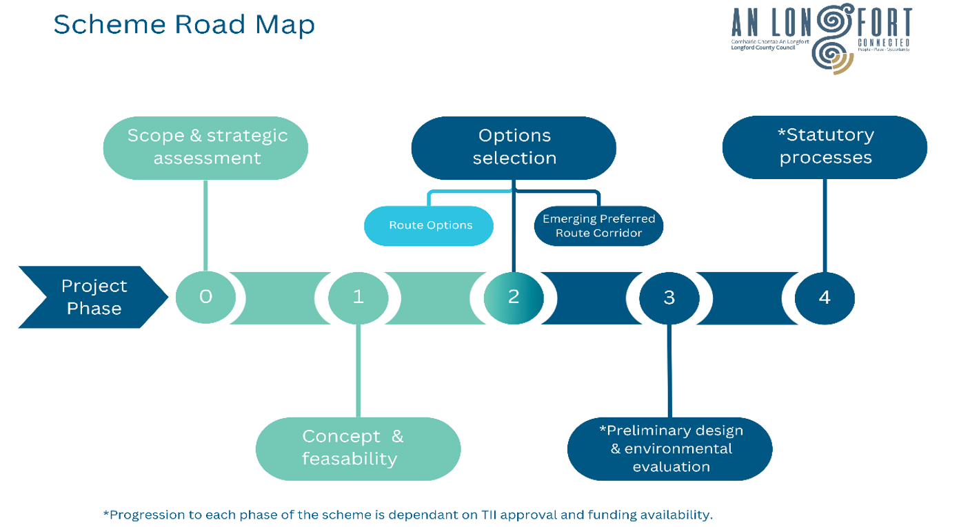
In accordance with TII's Project Management Guidelines, the scheme is currently at Phase 2 (Options Selection), during which potential transport solutions and route options are being identified and assessed. See Scheme Road Map below.
Westmeath National Roads Office will oversee the development of the Scheme, with AtkinsRéalis appointed as multi-disciplinary consultants responsible for progressing the Scheme through the various pre-planning phases.
The project team is currently carrying out the studies and assessments needed to identify and evaluate potential route options for the Scheme. This work includes a range of engineering, environmental, traffic and land-use assessments. As part of this process, a number of engineering and environmental surveys will be undertaken within the study area over the coming months. The information gathered will help the project team better understand existing conditions, assess potential impacts and opportunities, and support the selection of appropriate route options for the scheme.
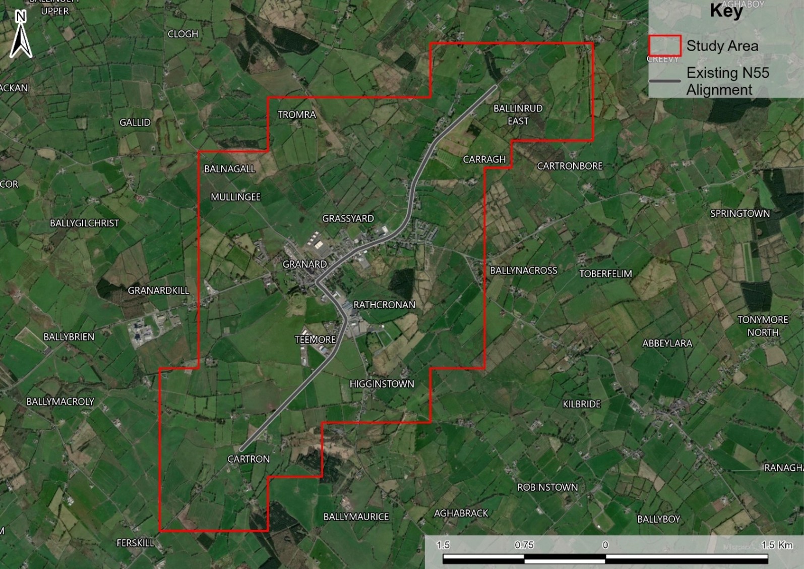
An initial Study Area for the Scheme has been identified and is shown in the map below.
What happens next?
Following the completion of the various assessments at this Phase, the project team will undertake a non-statutory public consultation to present the emerging route options for the Scheme, and to seek feedback from landowners, local residents, businesses, and other local stakeholders, including the relevant statutory bodies. Feedback received through this process will help inform the ongoing development and assessment of route options for the Scheme.
Following consideration of the feedback received and the results of the technical assessments at this Phase, an Emerging Preferred Route Corridor will be identified for the Scheme, to be taken forward to Phase 3 (Preliminary Design and Environmental Evaluation).
For Further Information
If you have any further queries or feedback regarding the Scheme, please do not hesitate to get in touch via phone or email below.
We welcome the opportunity to engage with you on the development of this Scheme and look forward to continuing to work with you as it progresses.
Enquiries to the AtkinsRéalis Project Liaison Officer:
Phone: +353 (0)181 08101
Email: N55GranardBypass@atkinsrealis.com
Post:
AtkinsRéalis
150 Airside Business Park
Swords
Co. Dublin
K67 K5W4